
Size of this preview: 800 × 390 pixels. Other resolutions: 320 × 156 pixels | 640 × 312 pixels | 1,024 × 499 pixels | 1,633 × 796 pixels.
Original file (1,633 × 796 pixels, file size: 1.62 MB, MIME type: image/png)
Summary
| Description |
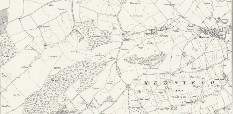
English: A map showing the Medstead parish in 1881. |
|---|---|
| Source |
Old Maps, Ordnance Survey |
| Date |
style="background: #EEE; color:black; vertical-align: middle; white-space: nowrap; text-align: center; " class="table-Unknown" | date???-??-1881 or 71 |
| Author |
Ordnance Survey |
| Permission (Reusing this file) |
See below.
|
Licensing
File history
Click on a date/time to view the file as it appeared at that time.
| Date/Time | Thumbnail | Dimensions | User | Comment | |
|---|---|---|---|---|---|
| current | 17:38, 5 September 2018 | | 1,633 × 796 (1.62 MB) | B (talk | contribs) | File is public domain - no need to reduce the size |
| 00:14, 4 February 2017 |  | 452 × 220 (185 KB) | DatBot (talk | contribs) | Reduce size of non-free image (BOT - disable) | |
| 13:42, 1 February 2017 |  | 1,633 × 796 (1.62 MB) | Jaguar (talk | contribs) | Uploading a non-free file using File Upload Wizard |
You cannot overwrite this file.
File usage
The following pages on the English Wikipedia use this file (pages on other projects are not listed):